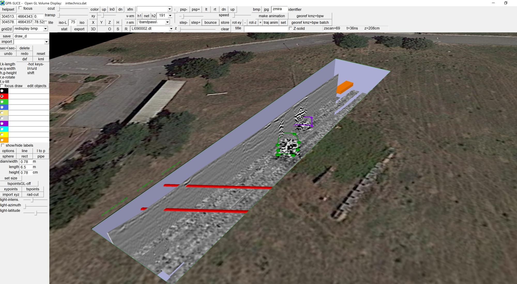
OpenGL Volume Draw menus can have utilities drawn in 3D and exported to DXF for import to AutoCad software.
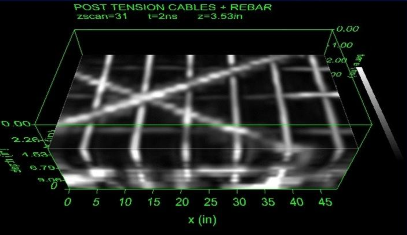
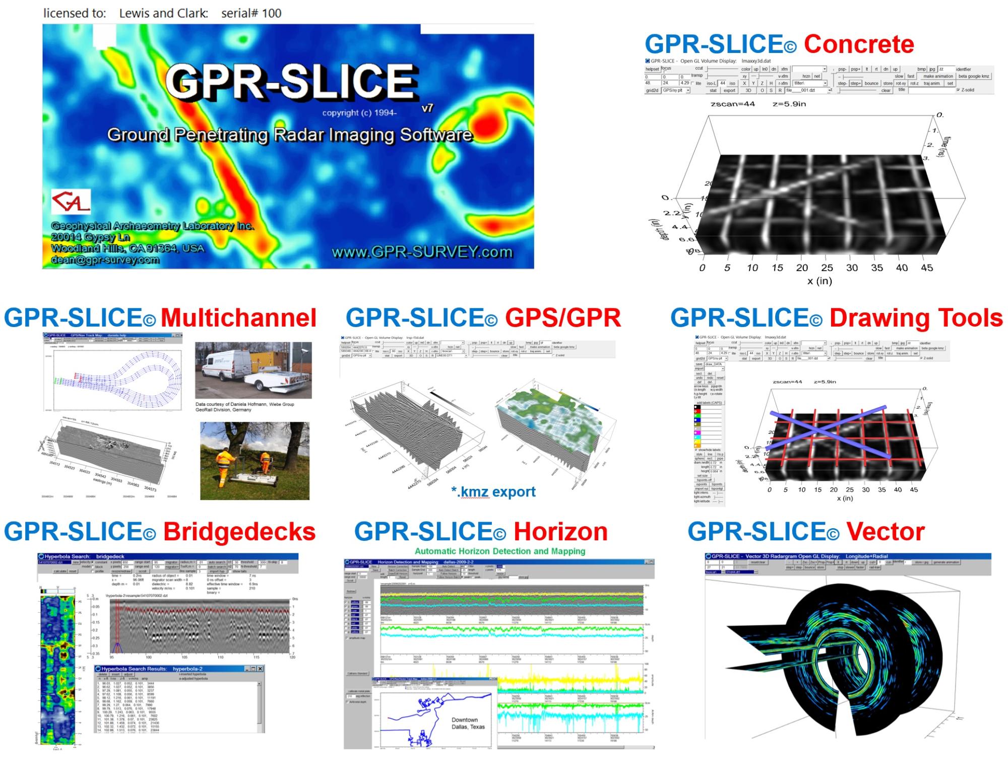
GPR-SLICE imaging of concrete structures with post tension cables and rebar.
GPR-SLICE is integrated with every manufacturer for GPS for seamless integration and interpolation across GPR/GPS tracks.
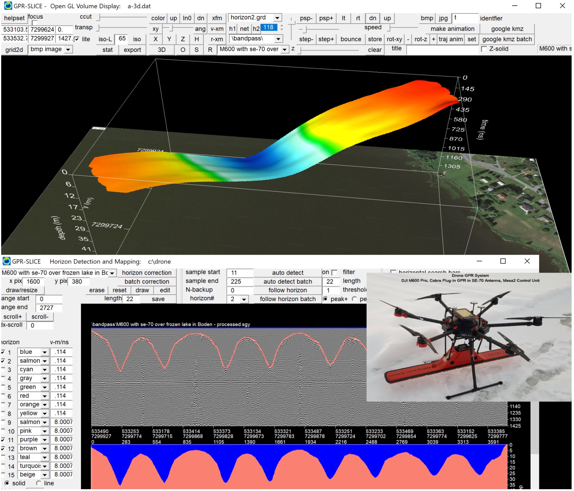
GPR imagery of a frozen lakebed bottom reflection measured using a GPR drone system. The antenna is a Radarteam AB Sweden (www.radarteam.se) subecho 70MHz that can stack 32000 scans/second. The heavy duty drone system is manufactuered by SPH-Engineering in Latvia (www.sph-engineering.com). The lakebed bathymetry is detected in the GPR-SLICE Horizon menu
**** GPR-SLICE version v7.MT is a MultiThread Software Package for Ground Penetrating Radar ****
!! Take advantage of the multiple processors on the computer for super fast operations !!
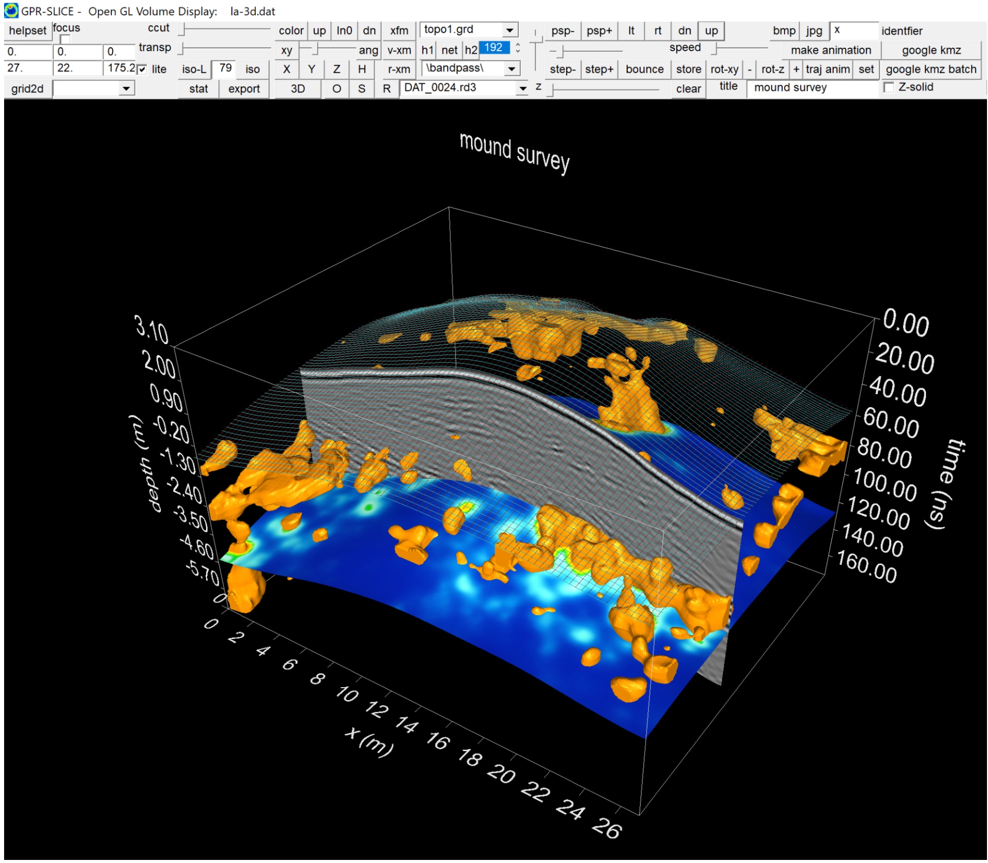
GPR-SLICE survey of a mound using real time topographic warping of radargrams, topo depth slices and topo warped isosurfaces.
GPR-SLICE OpenGL menus have augmented displays where below surface imagery or drawn objects can be seen overlaid on google earth or site bitmaps
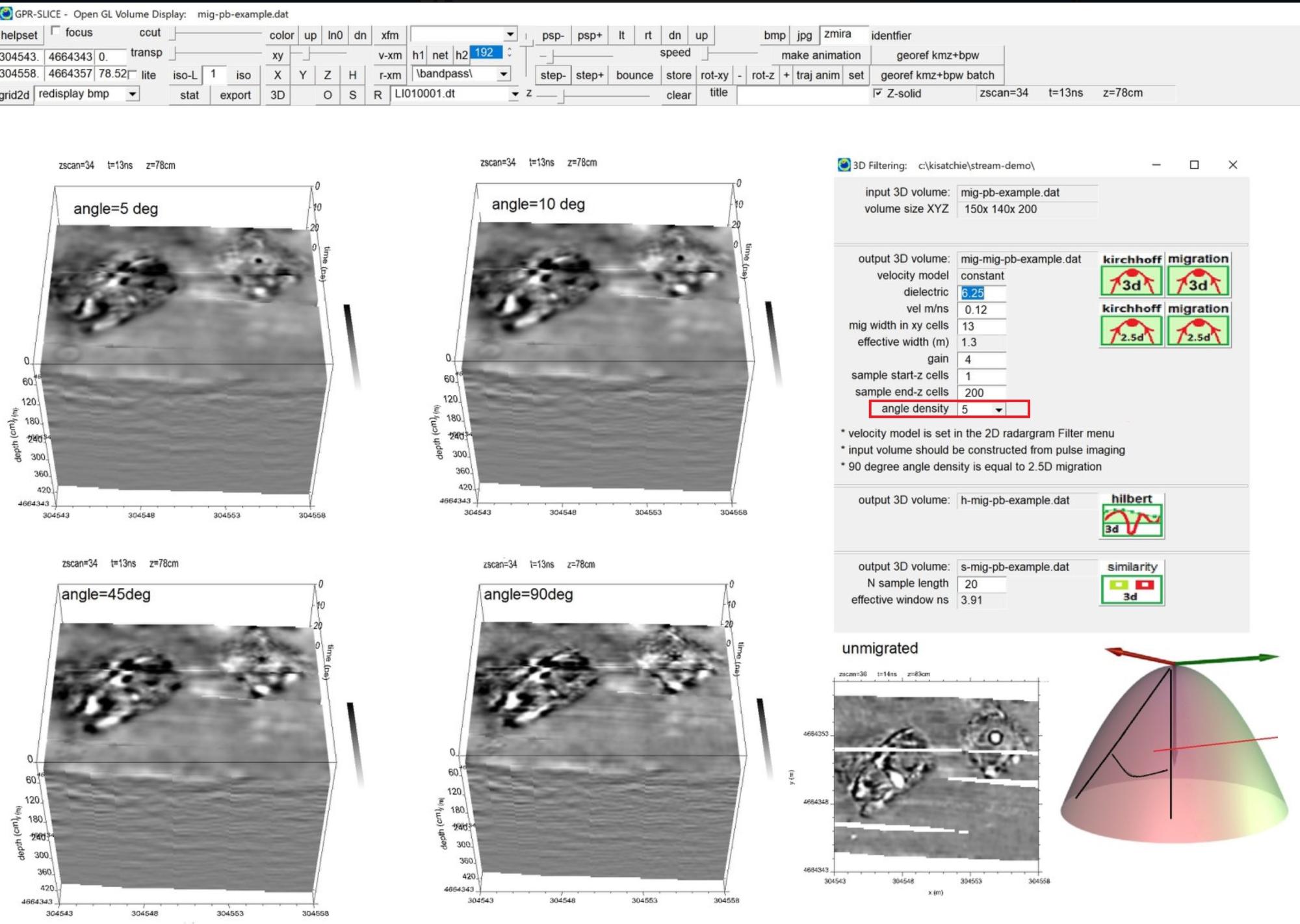
GPR-SLICE 3D migration with options to control angle junctures over the hyperboloid for streamlining processing time.
GPR-SLICE(c) GPR-SLICE v7.MT Ground Penetrating Radar Imaging Software
GPR-SLICE version v7.MT with MultiThread Processing is now being delivered on the Subscribers Only page. Take advantage of the multiple processors on the computer for super fast operations!!
GPR-SLICE v7.MT (1994-2021) is a comprehensive ground penetrating radar imaging software designed for creation of 2D/3D subsurface images for use in a variety of geotechnical, engineering and archaeological applications.
GPR-SLICE began development in 1990 and became a full commercial software by 1994. The first Windows version of the software was released in 2001. The software is directly marketed by the Geophysical Archaeometry Laboratory Inc. and our affliated worldwide distributors.
Proceq
IDS
Ditch Witch
ERA Technology
3D Radar of Norway
UTSI Electronics
Geoscanners
Leica
Koden Radar
GeoTech Russia
Transient Technologies
SEGY and SEG 2
Plus customized formats for research radar systems
ImpulseRadar
3D Radar
IDS
UTSI
Koden Radar
Isung
Radar Portal
*** with complete integration of GPS and total station
GPR-SLICE applies a unique process of radargram desampling/binning and then recreates GPR data volumes using estimation algorithmsfor single channel - coarsely spaced profile lines. For multi-channel dataset direct compilation to pulse 3D volumes can be quickly generated without interpolation because of the hi-density acquisition. GPR-SLICE handles all surveyed data densities to make the most comprehensive subsurface imagery. Many researchers have migrated to the software because of the professional quality images that can be created in the software.
GPR-SLICE Software features:
3D volume displays, Isosurface Rendering, Fence Plots
Antenna yaw, pitch and roll used in projecting scans
Longitudinal tunnel radar survey menu for automatic vector setting
Radial tunnel survey menu for automatic vector setting
Meandering track menu and automatic vector setting
GPS 2D/3D Time Slices
GPS 2D/3D Radargram Displays
Specialized menu for editting/filtering GPS fallout
Batch GPS topography corrections
Builtin UTM utility conversion
Exportability to GIS (world file creation)
Direct export to Google Earth (*.kmz image file creation
Builtin GPS staggering/scan lag latency correction
Complete GPS integration
2D surface displays and automatic animation creation
Open GL 3D real time flythroughs, x, y, z, xy fence diagrams, isosurface rendering
Open GL 3D radargram displays, with pulse thresholding and automatic animation creation
Open GL Object drawing for interpretation (pipes, rectangular volumes, spheres etc ) with DXF file creation
Cylinder volume warping for imaging tunnels
Automatic horizon detection
Layer depth maps using variable layer velocities
Horizon amplitude profiles and maps
Horizon slicing in Open GL 3D Volume
Radargram differencing for GPR monitoring
Volume differencing for GPR monitoring
FK Radargram filtering
0ns scan-by-scan or 0ns line-by-line offset auto detection/editing of radargrams menu
Migration with variable velocity profiles
3D/2.5D migration
Bandpass filtering and spectra menu
Spectral whitening
Deconvolution, spectral and spiking
Hilbert Transform
Boxcar smoothing
Background removal
Regain
Mosaic correction menu
2D FFT grid filtering
Overlay analysis
Grid math
Individualized map transform controls
Image synthesizing of GPR, Mag, Resistivity and EM using Overlay Analysis
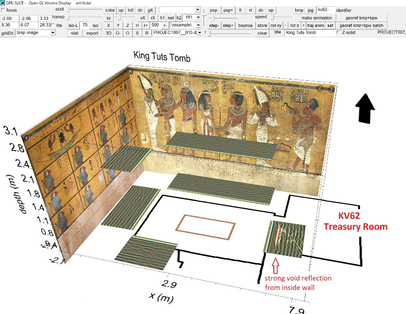
GPR-SLICE was used by the National Geographic Society in 2016 to study the north, west and south walls in KV62 - King Tuts tomb in search of corridors suspected of leading to Nefertitti's tomb. The results, shown in vector space comparison with a calibration wall reflection from the Treasury Room indicates that no corridors are present behind the walls in King Tuts Tomb at least to 2 meters depth. A follow-up 2018 survey that probed to a deeper 4 meters behind the walls by the University of Turino in Italy also found no void spaces indicating a hidden room or corridors exist. (Another survey in 2019 by an unusual surveying group using unshielded antenna in the narrow space of the tomb contradicts these findings - most likely by misrepresenting external engrained noises in the data as being internal to the wall. In any event - the search continues!!! )

GPR-SLICE drone survey showing a one of many long GPS profiles taken on a site along with a time slice - above YouTube video shows the complete dataset. (data courtesy Aero 360 Philippines)
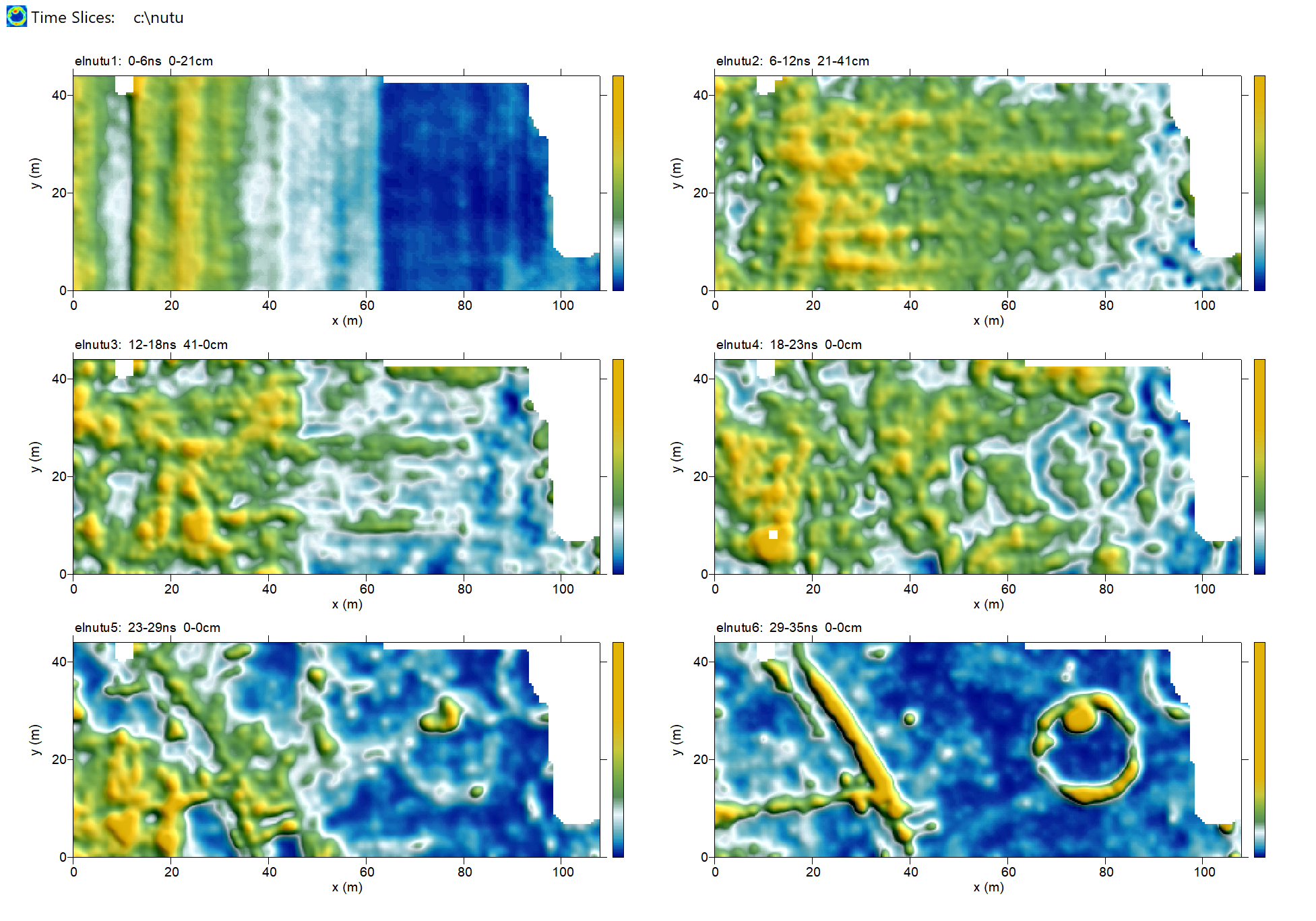
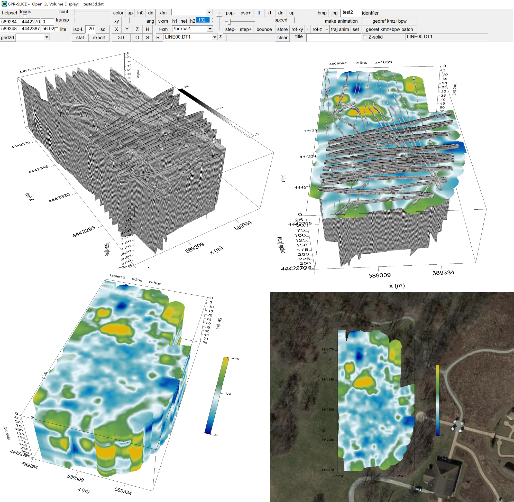
GPR-SLICE survey of the Nutubaru burial mound in Miyazaki, Japan with time slices displayed in shaded color.